
Saturday, July 30, 2011
Friday, July 29, 2011
Council Plaza and Grand Center Part 5: The Old Del Taco Building
 I like how the curve of the Del Taco building contrasts with the other buildings included in the National Register nomination.
 Once a gas station and then a taco stand, the building cuts a distinct profile at the corner of Grand and Forest Park Avenue.
 While the building was built as an auto-centric gas station, it could easily be converted into an oasis in the sea of concrete around the intersection.
 Efforts to save the building seem to have succeeded, and its redevelopment will hopefully come soon.
Thursday, July 28, 2011
Council Plaza and Grand Center Part 4: Accessability and Social Justice
 I couldn't help but notice what a horrible pedestrian environment Grand Boulevard provides south of Laclede to Chouteau. Perhaps the most galling problem is the double-decker interstate that cuts right through the middle of the area.
 Imagine being in a wheelchair, or even maybe a little less mobile than the average person, and walking through this mess of broken cement and weeds at the corner of Forest Park Avenue and Grand. For the residents of Council Plaza, the majority elderly or wheelchair-bound, this is not a theoretical exercise, it is reality.
 Then, after you somehow manage to cross over the broken pavement, you're faced with the overpass over the traffic sewer that Forest Park Avenue is at Grand. Pedestrians hate the roar of traffic, and avoid areas where they're subjected to it.
 Do you remember when Highway 40 only went under Grand? Already, in the 1960's, streets were being designed to move cars, not people.
 Nowadays, you are faced with the double-decker interstate at the same spot, with the claustrophobic east-bounds lanes above you...
 ...and the east-bound lanes roaring by below you. It's not surprising that the Fox Theater doesn't recommend its patrons take Metrolink, located south of the interstate to evening shows. A little known fact: Highway 40 follows the path of the old Manchester Avenue through this area. If you look closely at some of the buildings through the area, you can see storefronts facing the highway.
 When I visited Council Plaza, while gazing at the buildings, I couldn't help but notice all of the people sitting around inside the complex, almost like they were prisoners. I don't blames them; take a walk up Grand from the interstate sometime and imagine doing it in a wheelchair, or with a walker.
 I think it is a social crime that American society has gotten to the point where its elderly and disabled are warehoused away in an isolated apartment complex, removed from everyday society and the benefits social interactions provide to the psyche.
 A first step would be to fill in the underpass for Forest Park Avenue under Grand; the bridge is deteriorating and will need to be replaced soon. Why not fill it in and create a humane, pedestrian-friendly intersection? I frequently use Forest Park Avenue, and I would be fine with having my trip extended by 30 seconds at a traffic light at Grand, just so this intersection could reflect the energy so long suppressed in this area.
Wednesday, July 27, 2011
Council Plaza and Grand Center Part 3: The Apartment Towers
 Out in the middle of the open, right on Highway 40 but largely forgotten by just about everyone in town, I became fascinated with the two large apartment buildings of the Teamsters' Plaza development, designed by Schwarz and Van Hoefen. The shorter, Grand View Apartments, facing north-south, and the taller Council Tower, which faces east-west. As can be seen in the historic photo above, shortly after their completion, they were two of the first developments built in the Mill Creek Valley, along withe accompanying Del Taco building and office and shopping center built at the base of the Grand View Apartments.
 What makes this complex more than just your normal apartment building complex is the funky art that adorns the buildings. Take the large, abstract medallion hanging on both ends of the Grand View Apartments.
 Or the stylized, abstract lines of the fountain out front; at first I thought it was damaged, and then I realized it was the artist's composition. I like it nonetheless, and the effort the builders took to enliven the complex.
 The glass enclosed lobby, separating the ground from the second floor, is a perfect example of Modernist architects using technology to show off. The walls become superfluous, and the steel piers hold up the building above.
 Council Tower, still one of the tallest residential structures in the whole metropolitan, also featured two large brick walls on its east and west sides. The brick murals, truly unique to St. Louis, are still vivid in my memory from being a child in the 1980's.
 The west brick mural is gone for good replaced by a surprisingly nice white wall, but the east side is slated for restoration, so I've heard. I will cover the slow dismantlement of that side later this week.
 The rest of the grounds around the towers are in rough shape, including this gazebo or pavilion-like structure, which is not original, apparently.
 The grounds between the towers were largely vacant the day I was there, no doubt because of the intense heat that had settled over the city. It is a pleasant spot, decorated with oddly incongruous classical revival cement sculptures.
 I know the complex is under renovation, but this has to be one of the ugliest parts of the whole development, where someone at sometime cinder-blocked up the entrance to the parking garage in as brutal a manner as possible.
 I actually covered the complex years ago on this site, and it's interesting to go back and read what I wrote back then. Read the historic nomination form here.
Tuesday, July 26, 2011
Council Plaza and Grand Center Part 2: Urban Renewal
 Above is a Sanborn Fire Insurance map of the intersection of Forest Park and Grand Boulevards, where the Council Plaza would later rise in the 1960's. As can be seen in the map, Forest Park used to dead-end at Grand, at a now gone Handlan Park. Looking to the east on the map, one can see the western end of the sprawling Mill Creek Valley, torn down in the 1950's.
 Looking at this aerial photo east towards downtown, the extent of the clearance of Midtown unfolds for the viewer. It is stunning at how much was demolished, and in its place the familiar snaking path of Highway 40 (actually built on top of Market Street or Manchester Avenue) as well as the other on-ramps and other streets built in the aftermath of the wholesale clearance.
 What is fascinating is the viewer can track the building of Council Plaza; first Grandview Apartments went up, and the remaining three buildings, including Council Tower. Below, one of the first developments built was Laclede Town, once a model for urban renewal but not mostly torn down and replaced by green fields for SLU and Harris Stowe around Compton Avenue.
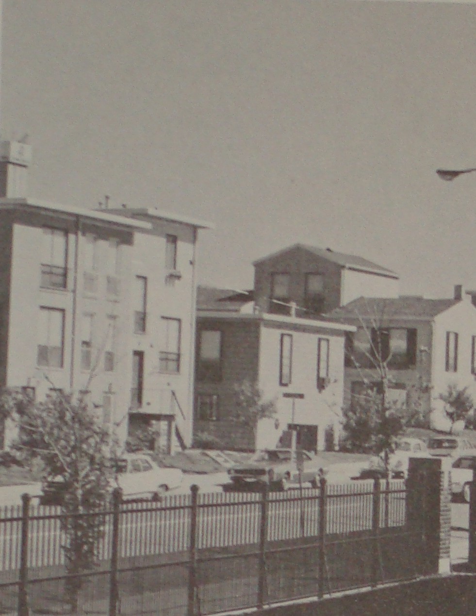 I've been told that Mill Creek still flows through a sewer in the area. Ironically, sixty years since clearance, some land still sits vacant.
All photos from "This is Our St. Louis" by Harry M. Hagen.
Monday, July 25, 2011
Council Plaza and Grand Center Part 1: Beginnings
 There has been much talk recently about the fate of the former DelTaco building in Grand Center; the gas station turned taco stand was part of the Council Plaza development, which transformed the area in the 1950's and 60's as the nearby Mill Creek Valley was demolished to the east of Grand, creating what locals called Hiroshima Flats. But long before the rise of Grand Center as an entertainment district and St. Louis's second downtown, it was a fashionable residential neighborhood, due west of the original core of the city. Above is the intersection of Grand and Washington
 Mere blocks from the declining private street of Vandeventer Place, in its time the most exclusive address in the city, people lived in squalor. Outside latrines besmirched the beautiful, but dilapidated Second Empire masterpieces that had long been cut up into rooming houses. Beyond a doubt, the living conditions of the streets west of Union Station and east of Grand were unacceptable, but the choice for wholesale clearance is debatable. Lafayette Square has proven that even the most rundown neighborhoods can be returned to their former beauty.
 To the south, the stately Grand Viaduct took traffic over the Mill Creek Valley, carefully assuring that the middle and upper classes of St. Louis could avoid the more unjust living conditions of the city. Tomorrow, we will look at how the Council Plaza development helped reshape the heart of Grand Center.
All photos from "This is Our St. Louis" by Harry M. Hagen.
Sunday, July 24, 2011

Saturday, July 23, 2011
The Admiral Has Left the Levee
 Above is an old photograph of the conversion of the Albatross to the Admiral, long an institution providing cruises up and down the Mississippi River. I never saw the Admiral in its glory days; by the time I visited the boat it was permanently moored on the riverfront. My family and I went to the grand opening of its retooling as a family amusement center; the air conditioning was broken and it was sweltering inside. I later visited it once to see its conversion to a casino, and it was obvious the boat has long seen better days. My students told me tales of grown men screaming at the sight of gigantic rats racing up and down the table games, while women always kept their purses in their laps to keep the cockroaches out of them. I wish the old boat could have been saved, but it was not to be.
Friday, July 22, 2011


Thursday, July 21, 2011
Soldiers' Memorial Details
The Soldiers' Memorial downtown is hard to photograph, so I provide some of the more interesting details of the building here. It is in no way a drab building.


Wednesday, July 20, 2011
A Bit of Northwest Dutchtown
 I think Dutchtown, however you define its boundaries, is one of the most beautiful neighborhoods in the city. Set amongst the rolling hills southwest of downtown, I often feel like I'm in Germany as I come down a hill and see a Gothic spire off in the distance.
 The architecture is varied as well, from solid brick houses with gingerbread accents to four family flats.
 And just when you think you've seen too much brick, the beautiful, Modernist Resuurection Church pops out at you on a quiet corner on Meramec Street.
Tuesday, July 19, 2011
Dioscuri and the Soldiers' Memorial
 I realized recently that the two horsemen out front of the Soldiers' Memorial are clearly based off of the famous Dioscuri statues which stand out front of the Palazzo Quirinale in Rome.
 Dug out of the ground during the Renaissance, these ancient statues were from the Severan period of ancient Rome.
 Read about them here, in Italian, by translating the page at Google.
Monday, July 18, 2011
Marillac College, Original Buildings
 The original charter house for the Daughters of Charity. Built in a stout Gothic Revival style, it still houses functions for the University of Missouri.


Subscribe to:
Posts (Atom)